Sunday, October 28, 2012
City View from Sunrise Mountain
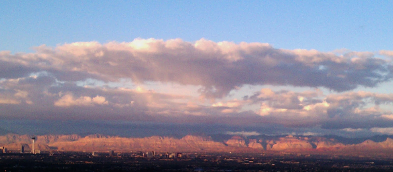
Today's travel takes us to Sunrise Mountain. Sunrise Mountain is located north east of the Las Vegas strip. Here are a few pics taken from Sunrise Mountain on a cloudy fall day earlier this month. Sin City looks quite angelic from this perspective.
Thursday, October 25, 2012
Tomatoes growing outside of 285
Today's travel takes us to the patio to see little fall cherry tomatoes.
One is just about ready for the pickin.....
Saturday, October 20, 2012
Death Valley, California
Last Saturday the temperature finally dropped, so I took a trip to Death Valley. This was also my first trip to California. Fortunately Death Valley is only about two hours from Las Vegas... and just in case you were wondering about 2,300 miles outside of 285.
Lets go.
After arriving in the park, you will encounter a kiosk where you are supposed to to stop and pay....which I did. It costs 20 dollars per car for a seven day pass. No..there is not a one day pass. The 20 dollar pass is the lowest one. There is not a gate or any type of security that I saw. You have to pay by credit card.
Once inside the park the first stop was Zabriskie Point.
Here are a few pictures from the top. I took these with an iPad...are they better than the phone I been using??
Death Valley covers a vast area. It requires a lot of driving to get from place to place. I spent more time inside my car than outside walking around. But anyway, after leaving Zabriskie Point, I headed to the visitors center to get some information. Then I drove to Badwater to see the salt flats.
The Badwater Basin consists of more than 200 miles of salt flats.
After Badwater, I drove to Mesquite Flat Sand Dunes. It was not difficult to walk on the sand because it was a little damp from prior rain.
After walking around on dunes, I headed back in the opposite direction to the Harmony Borax Works. Borax was processed here in the late 1800's.
I stopped at Dante's Peak on the way out of the Park. This view takes you 5,000ft above Death Valley. Now you can see how thh mountain ranges surround the valley below. The "white stuff" are mineral deposites. There is a small area of water located near the center of the picture below.
The road to the peak got really narrow and steep near the top. It felt like a roller coaster.
I saw two roadrunners on my trip. Just like the cartoon, they zoomed across the street. They moved too fast for a picture. I did not see any black folks, mostly European tourists.
Lets go.
| The Timbisha Shoshone are an Indian Tribe. According to the website 20-30 still live at death valley. |
Once inside the park the first stop was Zabriskie Point.
| Park and take a short walk to the top. |
Here are a few pictures from the top. I took these with an iPad...are they better than the phone I been using??
Death Valley covers a vast area. It requires a lot of driving to get from place to place. I spent more time inside my car than outside walking around. But anyway, after leaving Zabriskie Point, I headed to the visitors center to get some information. Then I drove to Badwater to see the salt flats.
How low can you go???
The Badwater Basin consists of more than 200 miles of salt flats.
There is a gas station inside of the park, but you need to fill up before you get here. I have NEVER seen gas this high. But is this a glimpse into the future???
After Badwater, I drove to Mesquite Flat Sand Dunes. It was not difficult to walk on the sand because it was a little damp from prior rain.
After walking around on dunes, I headed back in the opposite direction to the Harmony Borax Works. Borax was processed here in the late 1800's.
I stopped at Dante's Peak on the way out of the Park. This view takes you 5,000ft above Death Valley. Now you can see how thh mountain ranges surround the valley below. The "white stuff" are mineral deposites. There is a small area of water located near the center of the picture below.
The road to the peak got really narrow and steep near the top. It felt like a roller coaster.
I saw two roadrunners on my trip. Just like the cartoon, they zoomed across the street. They moved too fast for a picture. I did not see any black folks, mostly European tourists.
Sunday, September 30, 2012
Zion Park, Utah
Yesterday, fate blew me into Zion National Park in Utah. This park is located about 3 hours north east of Las Vegas, Nevada. Usually is costs 25 dollars per car to experience this wonder of nature. But September 29, 2012 was National Public Lands Day, so I got in for the low, low free. After doing a little research I decided to take part in one of the ranger lead hikes, but I got there too late. The time in Utah is 1 hour ahead of Nevada and I did not take that into consideration. When I got there I though it was 9:45, but it was actually 10:45. Oh well.....
The park has a wonderful free shuttle system. After parking near the visitors center, I took the shuttle to Weeping Rock. The Weeping Rock Trail is less than 1/2 mile long. It's in such a shady and damp area in the park that I got chill bumps from the cool air.
After leaving Weeping Rock I caught the shuttle to the Temple of Sinawava and completed the Riverside Walk. It is a little over 2 miles round trip.
After completing this easy hike, I took the shuttle to an area known as the Grotto. Once there I hiked the Kayenta Trail and the Lower Emerald Pools Trail.
Finally I took the Pa'rus trail from the Visitor's Center, to the Zion Human History Museum.
This is the view from behind the museum.
The park has a wonderful free shuttle system. After parking near the visitors center, I took the shuttle to Weeping Rock. The Weeping Rock Trail is less than 1/2 mile long. It's in such a shady and damp area in the park that I got chill bumps from the cool air.
There were constant drops of water from overhead. I got a little wet.
This area was very cool, damp and shady. I also caugh a glimpse of what looked like a Steller's Jay.
After leaving Weeping Rock I caught the shuttle to the Temple of Sinawava and completed the Riverside Walk. It is a little over 2 miles round trip.
I saw a few animals here. Mostly squirrles, a fox, deer, lizards, lots of butterflies and a few birds. I'm not sure what's going on with this guy, but he's loud.
Las Vegas is sooooo dry, I got excited to see the river flowing through and sculpting the canyon. This is the Virgin River.
After completing this easy hike, I took the shuttle to an area known as the Grotto. Once there I hiked the Kayenta Trail and the Lower Emerald Pools Trail.
Lower Emerald Pool
Can you spot the young buck, relaxing in the shade by the river?
Finally I took the Pa'rus trail from the Visitor's Center, to the Zion Human History Museum.
This is the view from behind the museum.
Saturday, September 22, 2012
Red Rock Canyon
Well, today I had planned to go to Death Valley. But when I mentioned this to a colleague, he suggested that I wait until it got cooler before heading out there. He suggested that I check out Zion National Park or Red Rock Canyon. So I choose to venture to Red Rock Canyon today. This adventure is still about 2,000 miles outside of 285, but luckily only 20 miles west of Las Vegas. So I checked out the website. It looked interesting so I decided to roll. My first thought.....this looks a lot like the Valley of Fire. My second thought.....nope, this place actually has lots of trees.
After a short drive I arrived at the gate, where it costs 7 dollars per car to get into the area. Then I headed up to the visitors center. It has a ton of information especially about the geology of the area. The exhibit is broken down into air, fire, earth and water sections. The people at the front desk were really nice and knowledgeable. Unfortunately, I did not see the tortoises that live there. I guess they were hiding in their holes. What's the difference between a turtle and a tortoise? Turtles swim.
After leaving the visitors center I took a drive on the 13 mile scenic road.
The first stop was Calico 1.
The next stop was Sandstone Quarry. I actually got out here and walked around for a while. Here are a few pictures. Luckily it was cloudy and there was a nice breeze.
After a short drive I arrived at the gate, where it costs 7 dollars per car to get into the area. Then I headed up to the visitors center. It has a ton of information especially about the geology of the area. The exhibit is broken down into air, fire, earth and water sections. The people at the front desk were really nice and knowledgeable. Unfortunately, I did not see the tortoises that live there. I guess they were hiding in their holes. What's the difference between a turtle and a tortoise? Turtles swim.
After leaving the visitors center I took a drive on the 13 mile scenic road.
The first stop was Calico 1.
The next stop was Sandstone Quarry. I actually got out here and walked around for a while. Here are a few pictures. Luckily it was cloudy and there was a nice breeze.
![]() |
| It was cloudy, but you can see a little blue poking through. |
![]() |
| What is this....a hot Cheeto????? Lets taste it and find out. |
![]() |
| At one point it looked like it was going to rain...but it never did. |
Sunday, September 16, 2012
Wow that's a lot of concrete!
Yesterday, I visited a very large mass of concrete that blocks a river and forms a lake. This structure is located over 19 hundred miles outside of 285.
The towering Hoover Dam (named for our 31st president) is located in Boulder City, Nevada, just south of Las Vegas. The dam itself is situated in Black Canyon. I spent an entire day at this landmark.
Before you enter the recreation area, you must first past a security checkpoint where a guard takes a look inside your vehicle. As long as your not a sheisty individual, you should be fine. Once you pass the checkpoint you can go check out the Callagan-Tillman Arch Bridge. The bridge is fairly new, just opening in 2010. As you climb the stairs to reach the bridge, there are several places where you can stop and read silver and black signs providing information about the bridge and it's namesakes. You can only reach the pedestrian bridge from the Nevada side.
Once reaching the top all you hear are cars, which are crossing the bridge too, and helicopters providing tourists birdseye views of the dam. Below are some pics I took while walking on the bridge's pedestrian walkway. Just in case you were wondering....yes it was hot. But still comfortable. (Or maybe I'm getting used to it.)
After leaving the bridge, I made way to the great Hoover Dam. It will cost you 7 dollars to park in the garage, but its worth it. Who wants to get into a scorching car after walking around all day?? Not I! It is amazing that this was constructed in the 1930's. The main purpose of this dam was to control the mighty Colorado River. Once the dam was finished it took 6 years for Lake Mead to fill.
Above you see the bridge I was standing on in the earlier pictures. You also have a better view of the Colorado River and the Black Mountains.
It's hard to capture the beautiful shade of blue eminating from Lake Mead. Here you can also see the flood line from 1983 and some water craft in the distance. I assume they can't pass that barrier.
![]() |
Lake Mead and Hoover Dam taken from the Mike O' Callaghan-Pat Tillman Bridge on 9/15/2012 |
The towering Hoover Dam (named for our 31st president) is located in Boulder City, Nevada, just south of Las Vegas. The dam itself is situated in Black Canyon. I spent an entire day at this landmark.
Before you enter the recreation area, you must first past a security checkpoint where a guard takes a look inside your vehicle. As long as your not a sheisty individual, you should be fine. Once you pass the checkpoint you can go check out the Callagan-Tillman Arch Bridge. The bridge is fairly new, just opening in 2010. As you climb the stairs to reach the bridge, there are several places where you can stop and read silver and black signs providing information about the bridge and it's namesakes. You can only reach the pedestrian bridge from the Nevada side.
Once reaching the top all you hear are cars, which are crossing the bridge too, and helicopters providing tourists birdseye views of the dam. Below are some pics I took while walking on the bridge's pedestrian walkway. Just in case you were wondering....yes it was hot. But still comfortable. (Or maybe I'm getting used to it.)
The 1st thing you see when you reach the top of the pedestrian bridge.
In this picture you can see Lake Mead (top), Hoover Dam and the Colorado River (bottom)
Straddling the state line.
Welcome to Arizona Sign
One man, Sherman Jones, died during the construction of the bridge. This is at the site in his honor.
Above you see the bridge I was standing on in the earlier pictures. You also have a better view of the Colorado River and the Black Mountains.
This was the 1st time I EVER heard of the Bureau of Reclamation.
It's hard to capture the beautiful shade of blue eminating from Lake Mead. Here you can also see the flood line from 1983 and some water craft in the distance. I assume they can't pass that barrier.
The "Winged Figures of the Republic" Statues taken from the overlook.
You gotta rub the feet for good luck!!
I also took a tour inside of the Hoover Dam to get a closer look. Stay tuned for that post...coming soon.
Friday, September 7, 2012
The Valley of Fire
If the temperature is over 100 degrees.....you may not need to visit a place called the Valley of Fire.
But of course,I visited The Valley of Fire State Park on September 3rd (a very special day to those in the know) and it was over 100 degrees. At one point it got sooo hot that I got confused.
This park is located about 50 miles outside of Las Vegas, Nevada right off of I-15 north. The drive from Vegas is pretty uneventful unless you like viewing desert scenery and driving fast. The speed limit goes up to 75 outside of town. It costs 10 dollars per car using the west entrance, from what I could tell on the east entrance you payed on the honor system....'cause I aint see no guard there!!
![]() |
![]() |
![]() |
| A 38 year old eye. |
There was also some signs of life. I saw a couple of lizards. I didn't see any snakes. The only sound heard was the wind, an occasional car and people speaking different languages. This, like some of the other places I visited were full of foreigners.
What animal does this look like???
Moon Face!!
If you ever come to Vegas, take a break from the sin. Get outside and see the Valley of Fire!!! It's a good day trip.
Subscribe to:
Posts (Atom)


